
Many of the visitors coming to southern Poland and Krakow region end up in Zakopane - the little town located at the foot of the Tatra Mountains. Some hike (or take a horse cart ride) up the easy and quite boring trail to the most famous landmark in Polish mountains - Morskie Oko lake which is undoubtedly picturesque and beautiful, but so overcrowded that it can get really irritating.
In this post, I'll try to encourage you to leave Morskie Oko behind and venture into the real, wild beauty of the area. As usual, the most attractive and stunning views are awaiting those who are brave enough to take a risk and explore something beyond the beaten path. I've already described the trek to Dolina Pieciu Stawow which is way nicer than the one to Morskie Oko and now it's time to write about my favorite trail in the Tatras - to Swinica peak via the less known Dolina Gasienicowa (Gasienicowa Valley) and Zawrat saddle. This trail features not one but several crystal clear lakes of different shapes and colors, spectacular views - incomparable with those on the way to Morskie Oko and it's perfect for those who love adventure and adrenaline rush!
The trail Dolina Gasienicowa - Zawrat - Swinica peak
First, you need to get to Zakopane. For more details, take a look at my post about this town here. From Zakopane city center (near the train station), take a mini bus to Kuznice (it shouldn't cost more than 1 EUR/1.25 USD) - the lower cable car station for Kasprowy Wierch. When you get off the bus, do not take the overpriced cable car to the top (although you could also get to Swinica Peak and Dolina Gasienicowa from Kasprowy Wierch).
Nevertheless, there is no point to do that as you would have to hike a lot anyway, and the views are better from the normal walking trail. All the trails in the Polish mountains are very well marked and each trail has a different color (which does not represent the difficulty). You can find a detailed map of all the trails here.
Kuznice - Murowaniec hostel - Dolina Gasienicowa
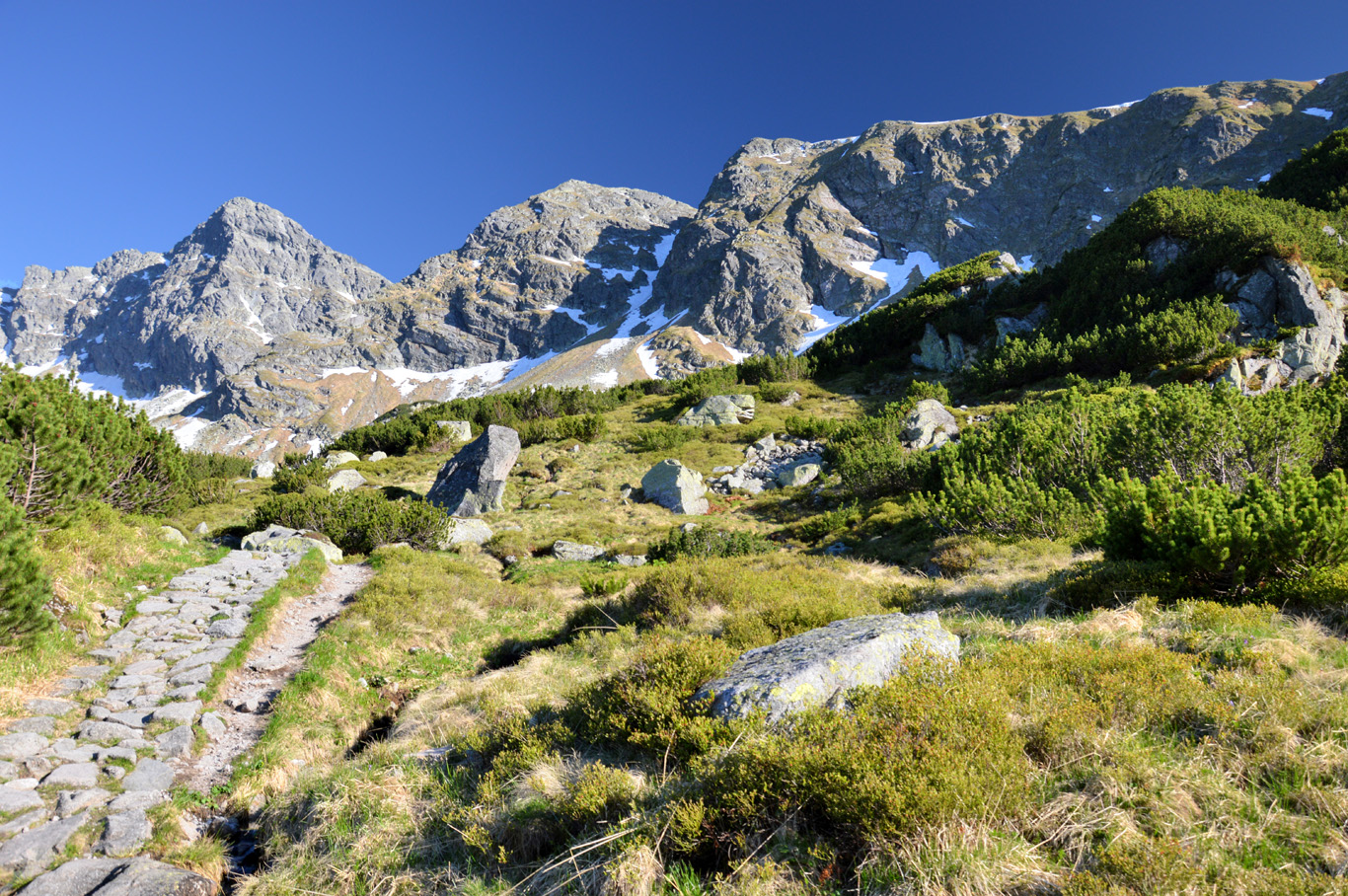
Near the Kuznice lower cable car station, find a sign with blue trail towards "Murowaniec" which is the name of a youth hostel located at Dolina Gasienicowa. This trails follows up a stony path through the spruce forest until the top of the mountain where Murowaniec is located. The hike should take around 2 hours. The views, near the end, are getting nicer and are typically mountainous, alpine-like. This part of the trail is not difficult although it can be a bit tiring.
Take some rest at the beautiful building of Murowaniec, have some lunch there. You can also sleep at Murowaniec, there's a bar and restaurant inside - the prices are really low. Do not drink tap water however - it's not potable! I tried it, I poured some water into a bottle and found rust and other particles at the bottom. I suppose it's way better to drink some water from a stream when you're up in the mountains.

Screenshot of a detailed map of the entire trek - the color represents the color of the actual trail

Near Dolina Gasienicowa
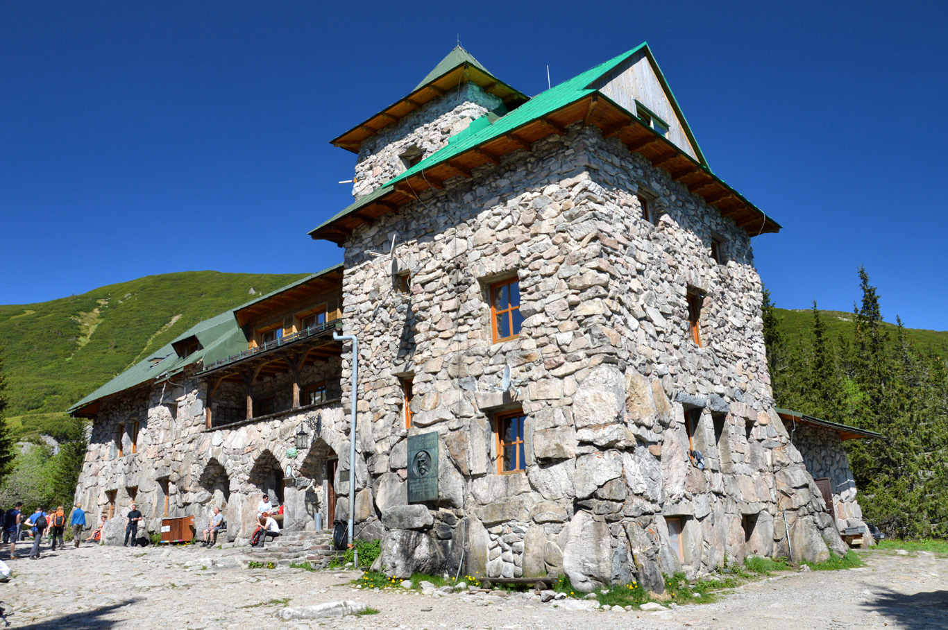
Murowaniec Youth Hostel
Dolina Gasienicowa

Zielony Staw
Zielony Staw

Kurtkowiec

Dlugi Staw
Dlugi Staw

Dlugi Staw

Dlugi Staw

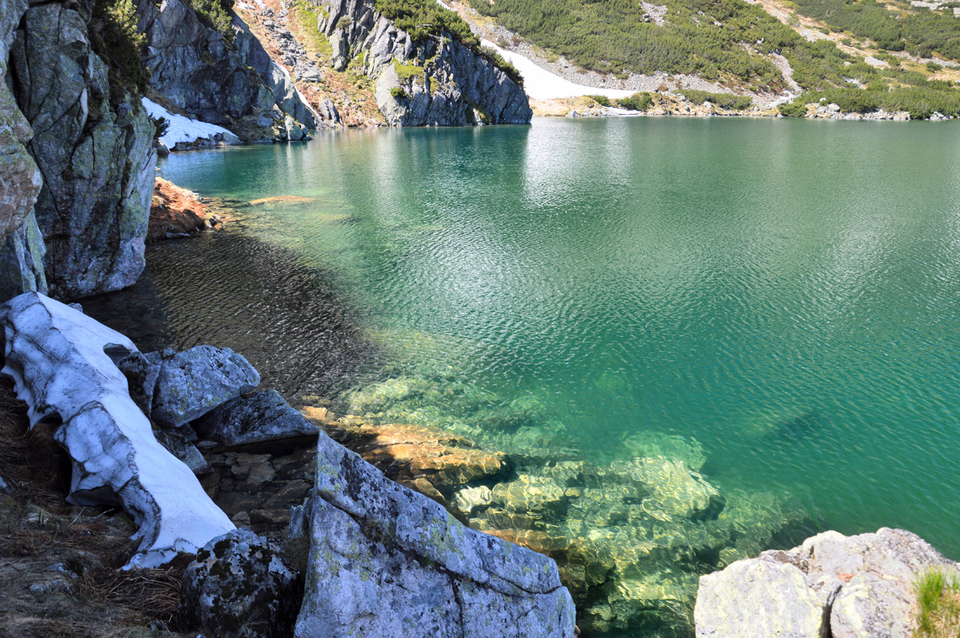
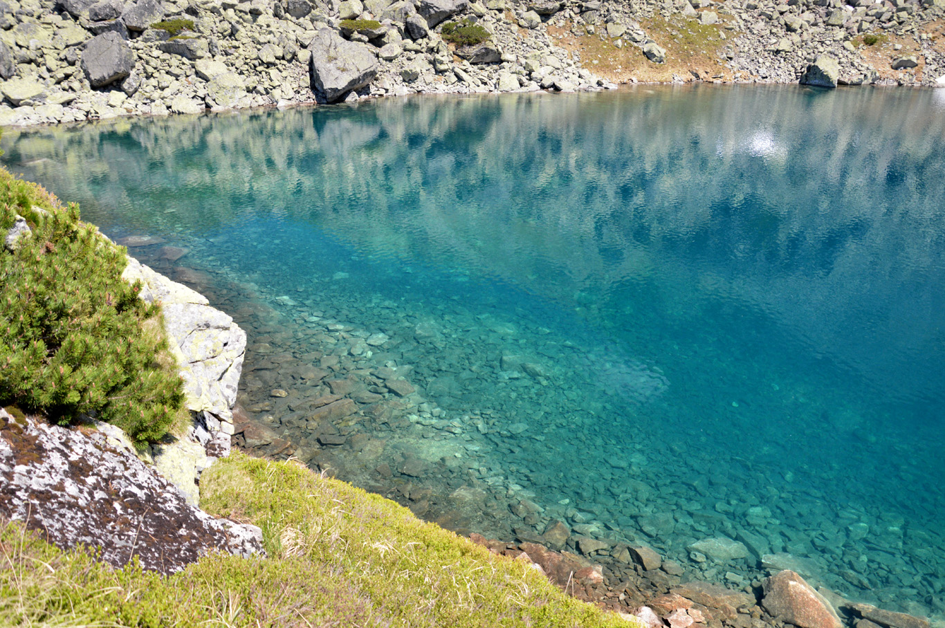
Crystal clear water of Zadni Staw

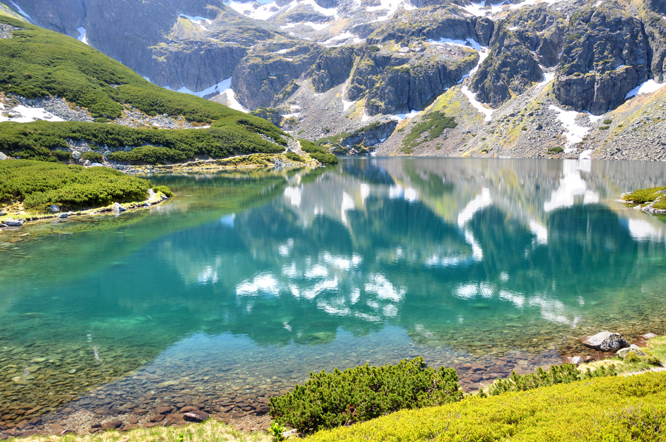
Czarny Staw Gasienicowy

Czarny Staw Gasienicowy

Czarny Staw Gasienicowy
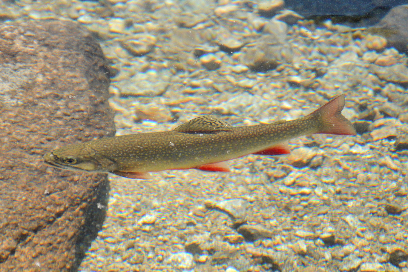
Mountainous trout in crystal clear waters

The water as clear as in the tropical sea
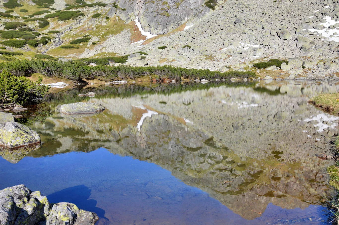
Beautiful reflection

Trail around Czarny Staw Gasienicowy
Dolina Gasienicowa - Zawrat
The sign says that the blue trail from Murowaniec to Zawrat takes around 2 hours 30 minutes. In practice, it takes longer - due to "traffic jams" and technical difficulties of the trail. You can either hike the blue trail right away, passing the spectacular, main lake Czarny Staw Gasienicowy or you can walk around the valley and see the other smaller lakes - Zielony Staw, Dlugi Staw and Kurtkowiec.
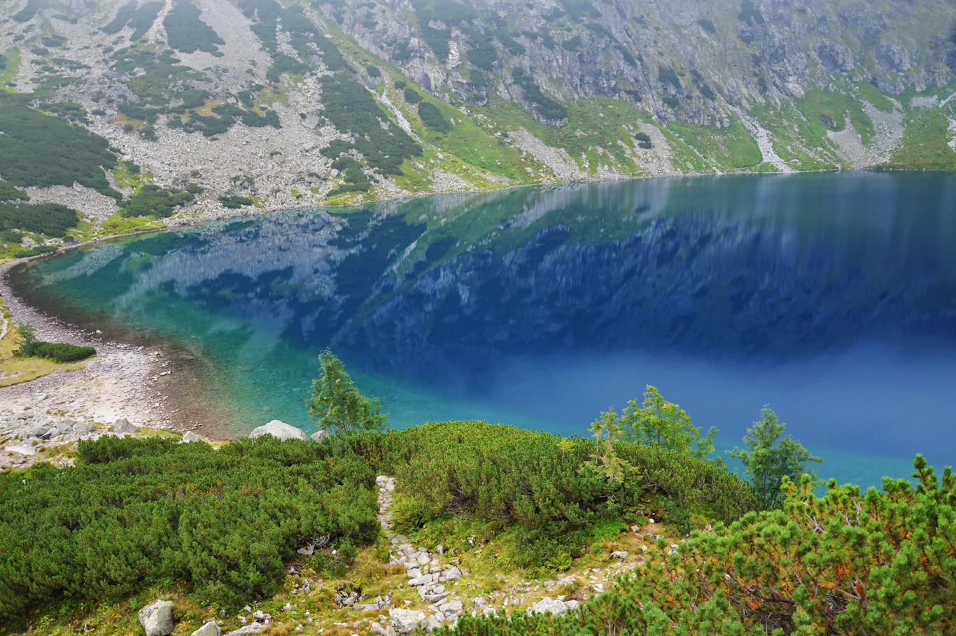
They all have beautiful, clear water of different shades of blue and green, however, the most stunning and impressive is the Czarny Staw Gasienicowy. Surrounded by high, pointy peaks (Swinica is the highest of them) and lush green mountain pine, at some point, due to its clarity, it looks like the Mediterranean Sea rather than a simple lake.
The trail from Murowaniec up to the Czarny Staw Gasienicowy is extremely easy, flat and at the same time so picturesque - in my opinion, the most impressive trail in the Polish Tatras. After admiring its beauty it's time to walk around the Czarny Staw and here is when the fun starts.
Now, the slope is getting very steep and you have to climb rocks all the way up to the top of Zawrat saddle. Halfway, you'll see another little lake called "Zmarzly Staw" which literally means "Frozen Pond". It is true as it can stay frozen until July! We climbed this trail in June, in places there was quite a bit of snow and, as you can see in the pictures - Zmarzly Staw was still half frozen.
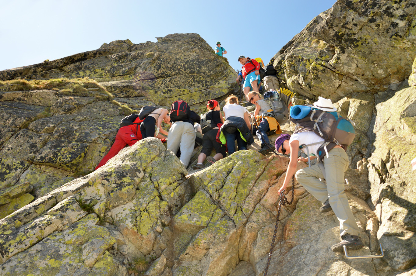
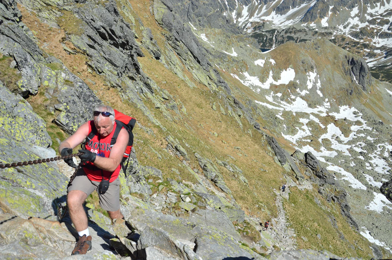
Here, the views are getting truly spectacular and... scary. The slope is steeper and steeper and you have to use some chains and iron steps fixed into the rocks for help. It was the most difficult part of the trail, not only because of the vertical walls but also due to snow and ice patches along the way. One step wrong, and you're dead. It was the scariest hike of my life. If you are faint-hearted and can't stand the heights, do not go up here. Quite a few people fall in this area (and trails around - especially the infamous Orla Perc saddle) while climbing to their deaths every year. Be extremely careful.
From down there, at the Czarny Staw lake, it didn't look that scary at all. That's why, many people who think they can climb it easily, get stuck somewhere on a ledge and are afraid or unable to go further up or back down (which is rather impossible with snow). This causes delays and traffic jams I've mentioned above. Therefore, always allow more time that the signs indicate.
Zawrat - Swinica (2,301 meters/7550 ft. above sea level)
When we got to Zawrat, we could finally breathe a sigh of relief that luckily, we are still alive. The view was spectacular - on the other side we could admire one of the lakes of the Valley of Five Lakes - Dolina Pieciu Stawow. Yes, from here, you can also hike to Dolina Pieciu Stawow - and it's easy.
We went the other way, however - towards the Swinica peak. It's one of the highest in the Tatra mountains. Again, the sing says the red trail takes 50 minutes from Zarat to Swinica, however, it takes longer in most cases.
The trail becomes extremely steep immediately from the start and you have to pull yourself up using the chains and metal steps fixed into the rocks all the way to the top. It's quite difficult, with vertical rocky walls and some scary, exposed ledges. But the views make it up for all the fear. Somehow, this part was easier for us than the part up to Zawrat from Czarny Staw Gasienicowy. Maybe because the slope here faces south, it gets much warmer and there was no snow or ice.
From Swinica you can see all the way to Kasprowy Wierch, over Dolina Gasienicowa and also Dolina Pieciu Stawow. Absolutely magnificent, indescribable feeling.

The view of the entire Czarny Staw Gasienicowy

Czarny Staw Gasienicowy

Zawrat saddle - the lowest point between the peaks, Swinica is to the right

The trail is getting steeper

Quite a lot of snow despite June

View from a point halfway to Zawrat - Zmarzly Staw in the middle

Zmarzly Staw

This child must be very brave

Chains attached to a vertical rock

Climbing up

Climbing up the chains

Amazing view over Dolina Pieciu Stawow from Zawrat

Blue color of the lake slowly unveiled by the sheet of ice

A crow

Vertical wall to the top of Swinica
Traffic jam
Climbing up

Almost on top

Swinica peak

View over Slovakian Tatras

Lakes on the left side of Dolina Gasienicowa

Kasprowy Wierch cable car station in the distance
The way back
To go back, DO NOT go the same way you came, since to climb down the chains (especially when there's snow around), is extremely dangerous. If you want to get back to Murowaniec, follow the red trail towards Kasprowy Wierch and turn right into the black trail at Swinicka Przelecz. It will lead you back all the way to Murowaniec (it's all marked on the map I've included in this post above).
If you want to get to Zakopane, you can either go down to Murowaniec and then Kuznice or to Kasprowy Wierch and from there take the cable car down.
Useful tips
- Be prepared for all weather conditions. It can change within minutes. We were there in June and although there was still snow around, the air got pretty hot and the sun in high elevations is extremely strong. We had jackets and raincoats but we ended up completely sunburned. If the forecast says anything about thunderstorms - do not go. I've experienced a horrible thunderstorm in the mountains and it's not a joke. I gave some tips what to do if you're caught in a thunderstorm here in this post.
- Try to do the hike from July to Septemper. We thought June is summer and yet there was still so much snow which made the hike extremely dangerous.
- It is possible to do the entire loop described here all the way from Zakopane in one day. However, it will be extremely tiring and if the weather changes, you might have to wait and climb back in the dark which is nearly impossible in difficult parts. The best way is to stay overnight at Murowaniec.
- Despite all the difficulties and warnings, the trail is simply amazing and if you have some experience in hiking, you don't need to be afraid - even children and elderly people can climb it - enjoy it!
Related Posts


Copying without permission is not allowed. If you wish to use any of the site's content (photos or text) or work with us, please contact us.
We welcome questions, advice, support or criticism. However, spam comments will be removed.