

Best Places to See in Lofoten - Part 2 - Best Beaches in the Polar Circle >>>
Vaeroy, Lofoten, Norway - One of the Most Unique Islands in the World >>>
Lofoten archipelago is a truly spacial place. It's located above the Arctic Circle and during the summer, the sun never sets (in winter, it never rises which is perfect for admiring Aurora Borealis). From June till August, you can walk around at 2 am and feel as if it was late afternoon.
Lofoten is extraordinary not only because of the unusual sunrise/sunset times. I must admit it is the most beautiful place on our planet I have ever seen so far. Surrounded by the vast Norwegian Sea connected to the Atlantic Ocean, the archipelago is warmed up by its waters and the climate is surprisingly mild, even in winter. The islands emerge suddenly right out of the sea and their pointy peaks resemble the highest parts of the Alps. Surprisingly, apart from the spectacular mountains, Lofoten has... tropical looking beaches that you'd never think could exist so far north. Perfect, white sand and turquoise, clear waters seem to be a carbon copy of the Caribbeans. All this unusual mixture of landscapes otherwise not seen side by side anywhere else creates a unique fantasy-like scenery that you'd more likely expect to see in a video game rather than in reality.
We started our journey across Lofoten from the tiny, southernmost island of Vaeroy and we continued up north. Take a look at the post about Vaeroy Here. Vaeroy is like the whole Lofoten, concentrated into a small island.
In this post I'll describe the islands of Moskenesoya and Flakstadoya.
Best places to see in Lofoten - the south
To be honest, "best places to see" is a tricky title. Lofoten is so unbelievably amazing that it's hard to believe your own eyes. As I mentioned, so far, after having traveled in more than 60 countries, this is the most beautiful part of our planet we've ever visited.
Lofoten looks like all the best natural wonders from around the world were merged into one and in one place. The pointy peaks of rocky mountains surrounded by paradise, white sand beaches with crystal waters, especially romantic when admired at midnight while the sun never sets. Words just can't describe the beauty of it all. Moreover, Lofoten is so remote that despite of being one of the most attractive places on Earth, it remains very authentic, real and still completely off the beaten path.
We arrived in Moskenesoya by car on the ferry from the little, separated by a larger area of water than the other islands - Vaeroy. A long road connects all the other islands with the mainland, except of Vaeroy. Please note that driving is the only reliable method of visiting Lofoten. Public buses are scarce and don't stop in all the places worth visiting. Hitchhiking and hiking is another option, but may take way more time.
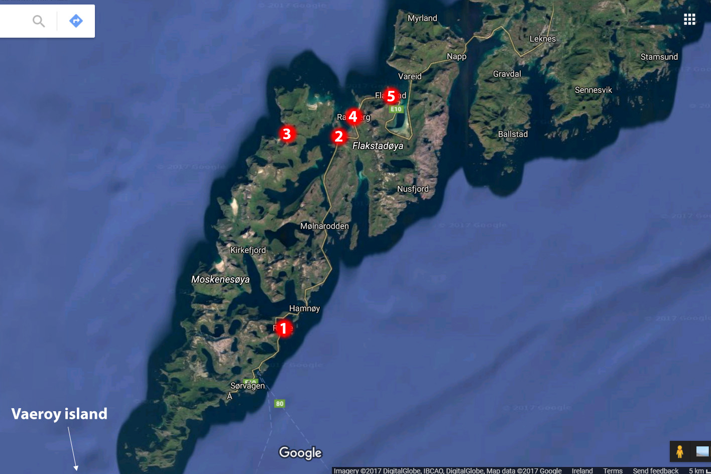
Lofoten map - Moskenesoya and Flakstadoya islands
Reine
Although it was around midnight, the sun was still up above the horizon. It was raining but even though the skies were covered by a thick blanket of clouds, it was still as bright as in early evening. We booked our first night in a beautiful, traditional style hostel in the village of peculiarly named "A". At first, we thought it would be hard to fall asleep because of the 24h sunlight, but in the end, we didn't have any problems.
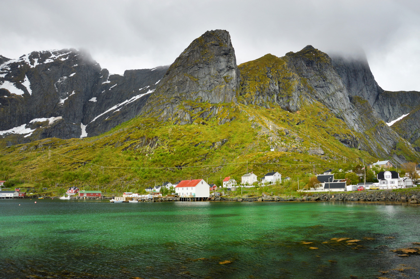
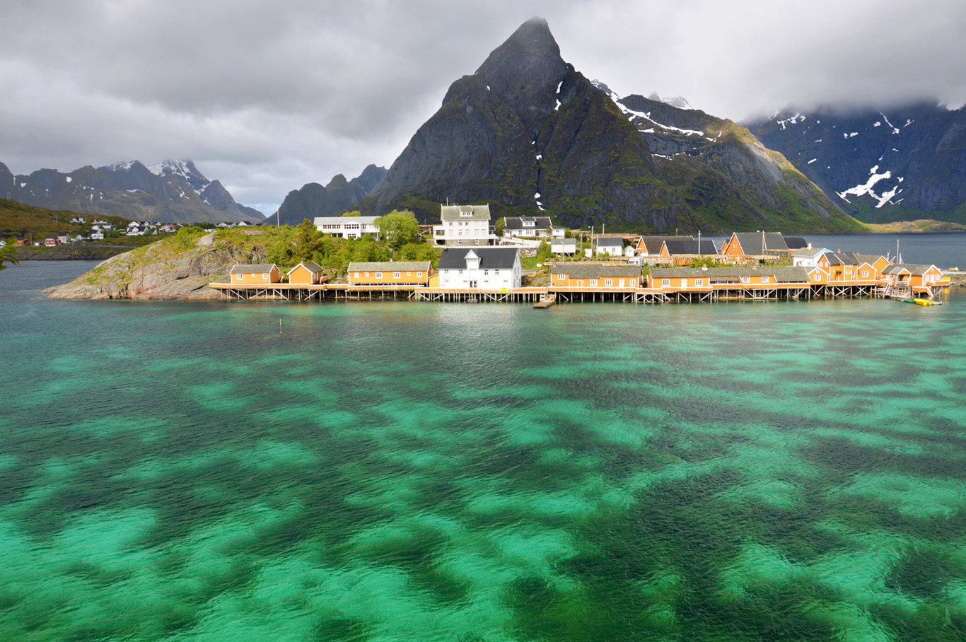
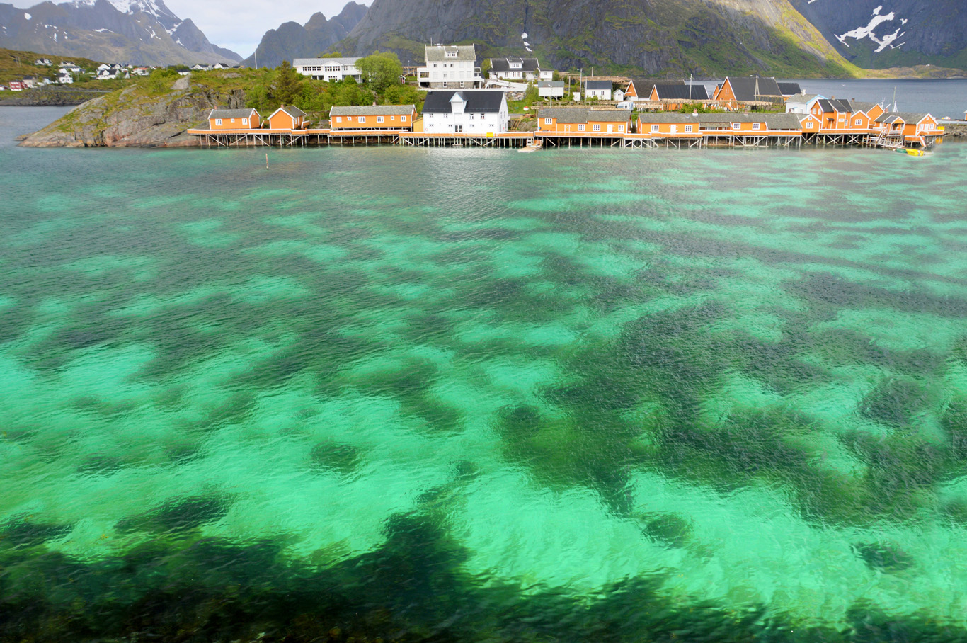
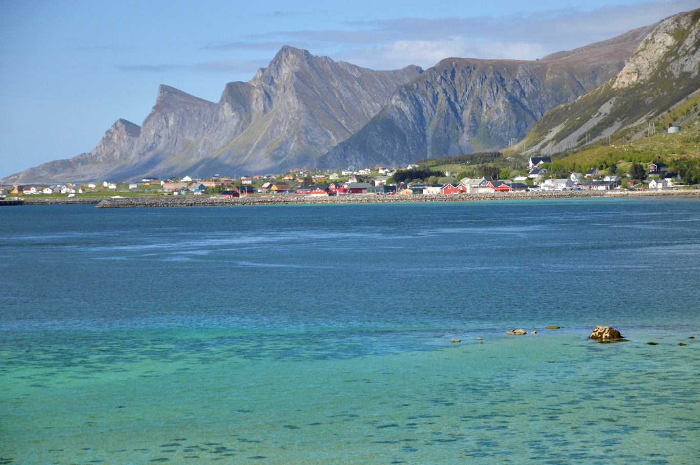
I've prepared a detailed map of what you should see, more or less; but when you drive through Lofoten, it's difficult to pin the places of interest on the map as it's all amazing along the way. Our first stop was in the little town of Reine (1 on the map) with the majestic, pointy mountains in the background. Although the weather was absolutely rotten on that day, the views made it up for the inconvenience of the wind and frozen rain hitting our faces with gale force.
The village of Reine is surrounded by a little lagoon with surprisingly clear, turquoise water. The rays of the sun that managed to brake through the clouds made it look somehow tropical. If you didn't know how cold it was outside, just by the looking at this amazing color of water, you'd love to take a swim! The traditional, red-painted fisherman houses give the final touch to this lovely setting. Reine is a must see and during your road trip through Lofoten!

Approaching Reine

Beautiful reflection
Near Reine

Fishermen houses
Reine

Reine

Reine
Spectacular color of the sea illuminated by the sun

Typical countryside in Lofoten

Roads in Lofoten

View over Fredvang Bridge
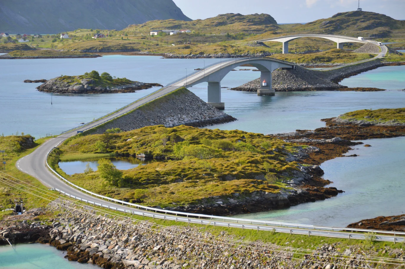
Fredvang Bridge
Fredvang Bridge
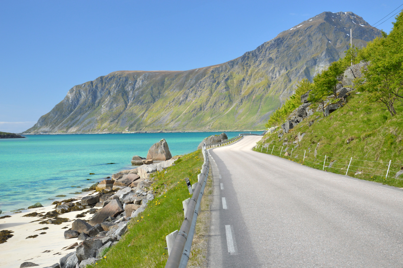
When we left the village, traveling on, admiring the sea and the mountains mixed all together into one, we stopped at the impressive Fredvang Bridge (number 2 on the map). It connects the island of Moskenesoya with Flakstadoya, although it is not the only bridge between those two islands. Built in 1988, smoothly blends into the natural scenery.
The best view of the bridge is from a higher level, so if you have more time, I would recommend hiking one of the nearby hills. Following the road, you can reach Fredvang camping and a wide beach. But don't spend too much time on that beach (unless you don't like hiking as there is a way better beach around the corner - see below).
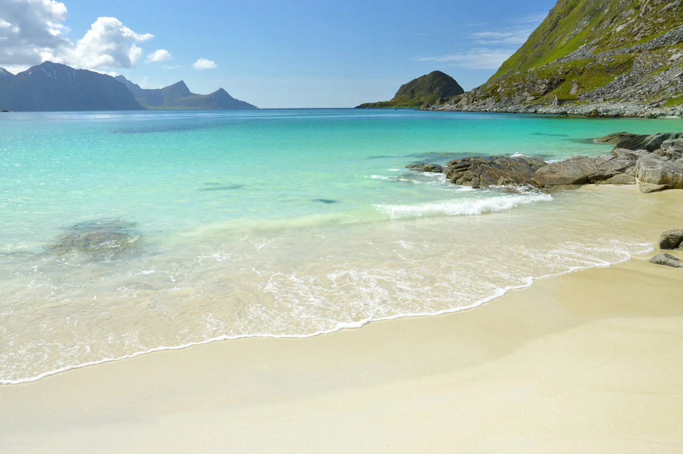
Kvalvika Beach
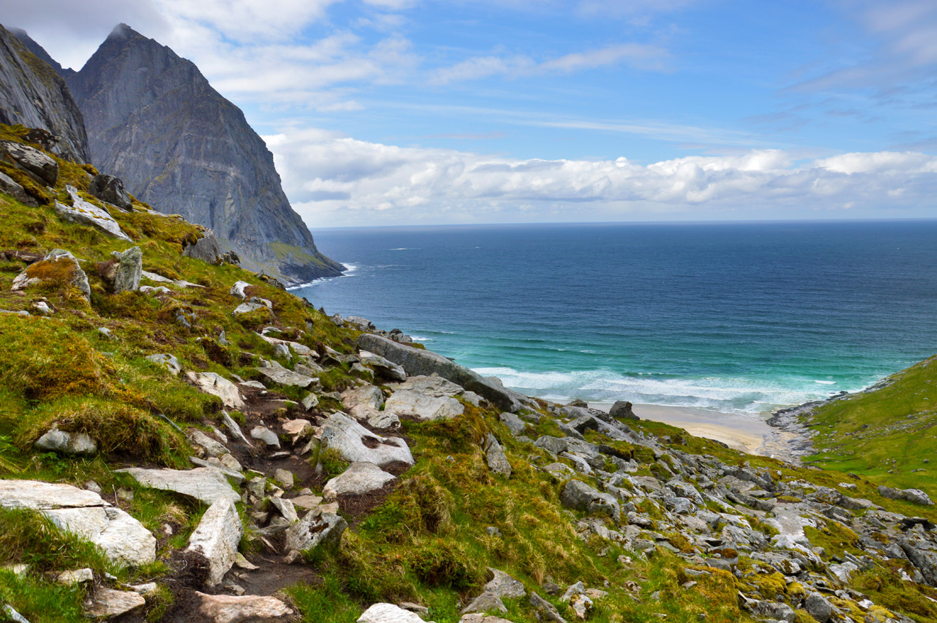
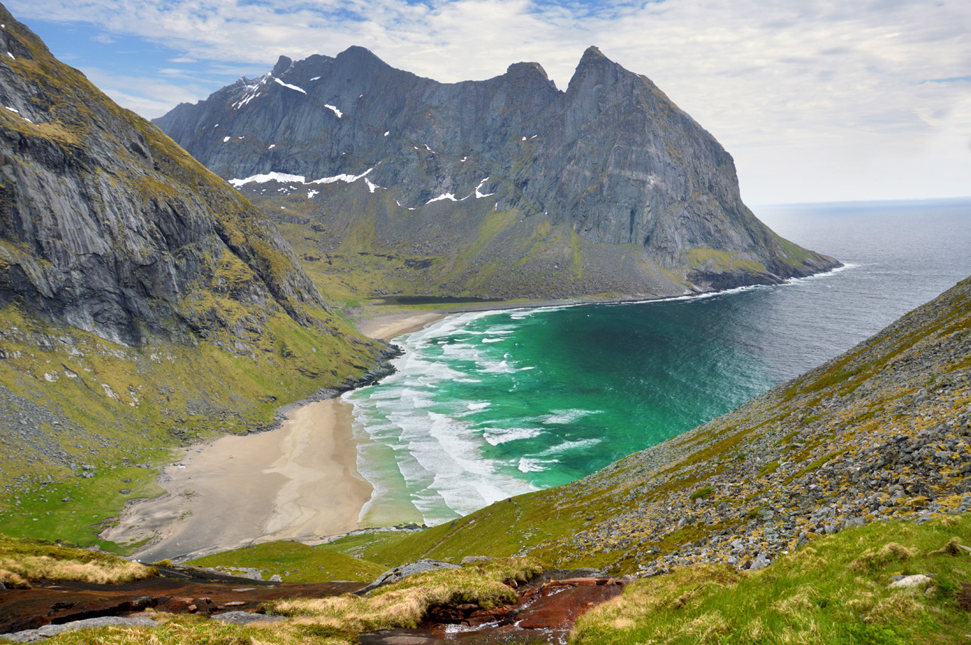
Kvalvika beach (number 3 on the map) is definitely the highlight and the most amazing place featured in this post. However, it's the most difficult place to reach in Lofoten (I'm talking about the reachable places, because some other amazing beaches require a day hike).
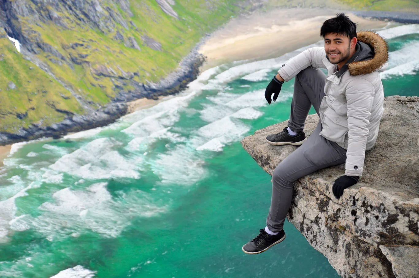
So how to get to Kvalvika beach? Continue down the road after crossing the Fredvang Bridge until the Torsfjord car parking area. Now you have two options - one easy and the second one - way harder. I would opt for the second option, nevertheless, if you're not afraid of hiking. The first option is the short hike to the beach itself which shouldn't take more than 40 minutes. The hike is quite easy. But then, if you're brave enough, go to the top of the hill on the right hand side - the slope is very steep, the weather extremely unpredictable, the ground is full of wetlands, but the view from the top compensates for all of it more than you'd expect. It takes over 1 hour to get to the top from the beach. Try to take an amazing photo on that rocky ledge - it looks spectacular and it's pretty safe as there is some ground underneath.
We couldn't stay long because a few minutes after we reached the top of the cliff, a snowstorm came. Without preparation and proper clothing, we almost froze so don't make this mistake and take a good warm jacket, even if it's summer and the sun is shining in the morning. It was a surreal experience to see the turquoise sea, white sand and snowflakes at the same time. At least it was easier and faster to run down and when we got to the sea level, it became a bit warmer and snow turned into drizzle.
Completely soaked, we entered the wooden fisherman house that we had rented and the coziness of the place and possibility to sit around the fireplace was just perfect for us - tired and soaked through. Lofoten and Norway are extremely expensive, so to save money - travel in a group and rent a beautiful cabin where you can prepare your own meals.
Approaching Kvalvika beach
Kvalvika seen from the trail to the top
Best view of Kvalvika

Kvalvika beach

Kvalvika beach

Fradvang Bridge seen from Kvalvika cliff
Around Fradvang Bridge - on the way to Falstad
Ramberg beach
From Kvalvika, coming back through the Fredvang Bridge and continuing north, you'll see Ramberg beach (number 4 on the map). It is yet another beautiful and very easy to get to beach - just off the main road. If you can't hike, you can enjoy your time here. Note that the photos from Ramberg beach in this post were taken just before 2 am. As you can see, it was perfectly bright. Amazing experience!
Flakstad Fjord
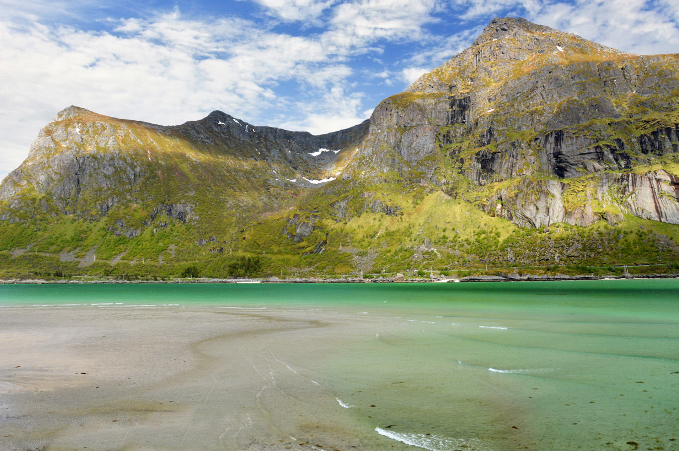
The fjord near the village of Flakstad (number 5 on the map) is absolutely spectacular and the best thing is that you don't have to go anywhere off road to see it. It's along the main road towards the north and the mainland. It drags for around 20 minute drive and the views are unreal - white sand, crystal clear water and beautiful, snowy peaks of rugged mountains. It's an ideal place for a picnic as there's so much grass around - you definitely must do it on a nice day!
It's difficult to describe all the places in Lofoten in words. When we were going back, the winds calmed down and the surface of water was perfectly still allowing beautiful reflections to appear. It seemed almost too perfect. Just look at the photos in this post, but to be honest, the images don't give the real place justice even in 10 percent!

Ramberg beach at 2 am - enjoying the midnight sun
Around Flakstad

Nearly tropical color of the sea

The blue sea and the mountains

White sand beach with the mountains in the background
Typical road in Lofoten

The darkest time of the day on June 1st - 1:30 am
Related Posts


Copying without permission is not allowed. If you wish to use any of the site's content (photos or text) or work with us, please contact us.
We welcome questions, advice, support or criticism. However, spam comments will be removed.